Stratfield Mortimer Evidence Base
NDP Submission
2 Pre-Submission Consultation Statement
3 Pre-Submission NDP October 2015
Neighbourhood Plan Overview
4 Designation of a Neighbourhood Area - Stratfield Mortimer
5 Guide to Neighbourhood Planning CPRE
6 Neighbourhood Development Plan guidance – Hereford Council
7 Neighbourhood Planning Road Map Locality
8 Proposed Neighbourhood Plan Area West Berkshire Council
9 Advertisement of intent to designate
10 Call for volunteers October 2013
11 Steering Group Terms of Reference
Stratfield Mortimer Parish Overview
12 Background statistics of Stratfield Mortimer, March 2011
13 Census 2011 - Mortimer Key Data Statistics
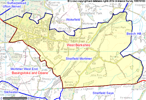
18 Stratfield Mortimer Area Map
19 Stratfield Mortimer Parish Aerial Map
20 Stratfield Mortimer Village Aerial Map
21 West Berkshire District Profile 2013
22 Dataset for Mortimer Profile
Key Policies
23 National Planning Policy Framework
24 West Berkshire Core Strategy (2006-2026) Development Plan Document Adopted July 2012
25 West Berkshire Council Strategic Housing Land Allocation Assessment Dec 2013
26 West Berkshire Council Strategic Housing Land Allocation Assessment Maps
27 Spatial Strategy The East Kennet Valley - The Vision
28 Housing Site Allocations DPD Preferred Options East Kennet Valley Spatial Area (Mortimer) Aug 2014
29 Housing Site Allocations DPD Spatial Area - East Kennet Valley November 2015
30 Neighbourhood Planning General Regulations 2012
31 West Berkshire Council Statement of Consultation App D [Page 68]
Consultation, Justification and Evidence
Summary Justification and Evidence
32 Introduction
34 Policies - Summary of Evidence and Justification
36 Mortimer Site Allocation Evidence Densities
37 Initial Public Meeting March 2014
39 Exhibition February/March 2015
40 Questionnaire Consultation April/May 2015
41 Site Design Review September 2015
42 Housing Needs Survey Report
43 Designation of ‘Local Green Spaces’
46 Strafield Mortimer Parish Council Minutes
47 Stratfield Mortimer Parish Council Response to Consultation 2014
48 Pre-Submission Consultation Statement
49 Pre-Submission Consultation Detailed Representations and Responses
50 Site Impact Assessment and Mitigation
52 Letter confirming SEA HRA Determination
53 Delivering New Homes and Retaining the Housing Stock CS 1 WBC
54 April 2007 Affordable Housing Supplementary Planning Document
56 Housing Type and Mix CS 4 WBC
57 The West Berkshire CIL Viability Study (January 2013)
58 West Berkshire Community Infrastructure Levy (CIL) 2015
60 Site Assessment and Sustainability Appraisal/Strategic Environmental Assessments
61 WBC Housing Site Allocation DPD Preferred Options - Stratfield Mortimer (PP4)
62 Evidence for Reserving Land for New St. John's School
Design
63 Design Principles CS 14 WBC
64 Building for Life 12 (3rd Edition)
65 HARAH-Rural-Design-Guide Combining Policy and Quality May 2013
66 Quality Design Supplementary Planning Document (SPD) West Berkshire Council June 2006
67 Achieving Quality Design _Part_1_
68 Residential Developments _Part_2_
69 Residential Character Framework _Part_3_
70 Sustainable Design Techniques _Part_4_
71 External Lighting WBC _Part_5_
72 Stratfield Mortimer Village Design Statement 2007
73 Planning and Development Briefs: A Guide to Better Practice (2007)
74 Planning Practice Guidance - Design (National Planning Policy Framework)
Flooding
76 Environment Agency Surface Water Flood Map of Parish
77 Environment Agency Surface Water Interactive Flood Map
Stratfield Mortimer 2007 Flood Report
78 West Berkshire Council Flood Report
79 West Berkshire Council - Spring Lane Flood Map
80 West Berkshire Council - Eatern End of Village Flood Map
Infrastructure
83 Notes of meeting with WBC re Education
Commercial and Employment
Biodiversity
86 Biodiversity Area 13 Berkshire (Berkshire Local Nature Partnership)
Green Spaces